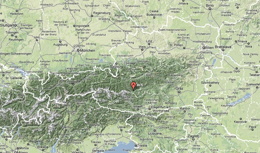
Just like last year, I joined my sister with her family, my father with his friend and her family on a skiing trip. The place – “Ferienparadies Wiesenbauer” we went to is about 4-5 hour drive from Malacky, in southern Austria region called Lungau. The vacation retreat that once was a farm is located about 1 km from the closest village – St. Margarethen – right at the foot of the Aineck hill.
Google Maps map
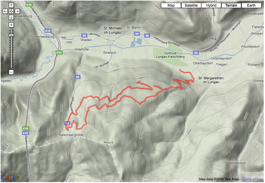
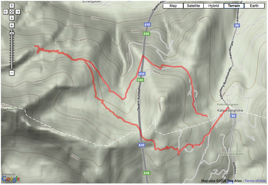
Dec 27: Wiesenbauer – Sandrieshutte – Katchberg loop
The first day after we arrived I took off in the morning to climb up Aineck to find the cross-country trail that a brochure provided by the host mentioned. After climbing for about 1.5 hour I found it – a nicely groomed for skating as well as classic skiing. I followed it to a ski center Katschberg. Not wanting to go back the same way I decided to walk on the main road for about 1 km down towards St. Michael to a forest road. That lead me back to a spot close to the downhill ski runs where it descended switchback-style down to the valley. There wasn’t much snow in elevations below 1200 m so I carried the skis some way down the hill.
The map below shows an incomplete track as my GPS run out of power.
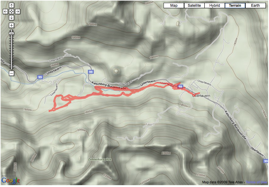
Dec 28: Obertauern
My father, Daniela, Jakub and I visited a ski-center Obertauern where we skied on a well-maintained set of x-country tracks. It was a “different” experience for me as I did not bushwhack that day 🙂
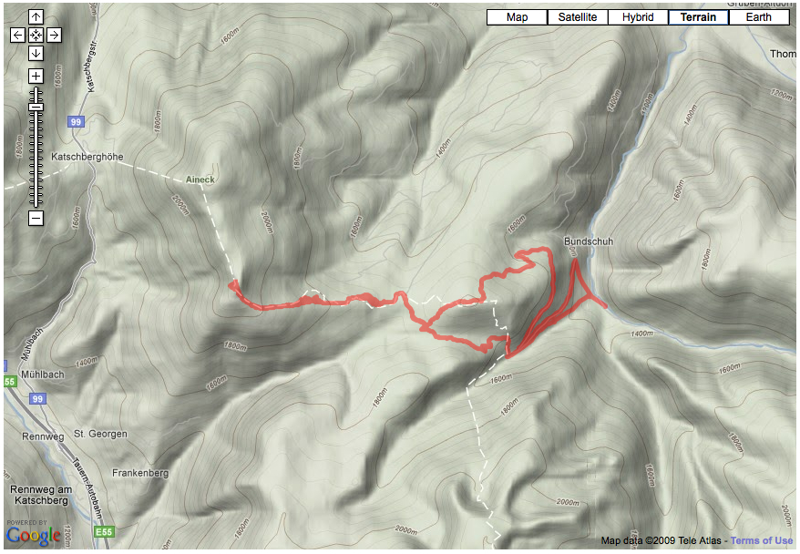
Dec 29: Katchberg – Wengeralm – Gontalscharte loop
This was my first trip into austrian Alps back country where I found some examples of mountain architecture. Pictures should tell the story.

Doktoralm


Wengeralm

Speiereck

View north from the Gontalscharte pass
Dec 30: Teuerlnok climb
As all I had with me were cross country skis and we were surrounded by high peaks of the Alps I decided to do a classic (no skis) hike up to Teuerlnock. to not miss a view from a real peak. After reaching the pass above the Bonner hutt I wasn’t very sure I was going to make it all the way to the top as I had to hike in places in snow about a foot deep without snowshoes or skis. I made a break in a shepherd hut above the pass and had some granola bars with hot tea which poured fresh energy into my body. Another positive moment was that the snow on the ridge leading to the top was hard as it was beaten down by the winds so I walked on top of it with much less difficulty. The weather was little windy but sunny with great views from the top – a great experience. On the way back I hiked over Schongelitzhohe and after some bushwhacking joined a forest road that lead me to my car.


Views from Teuerlnok

Eineck from Teuerlnok

View from the forest road below Schongelitzhohe

Reifensteineralm
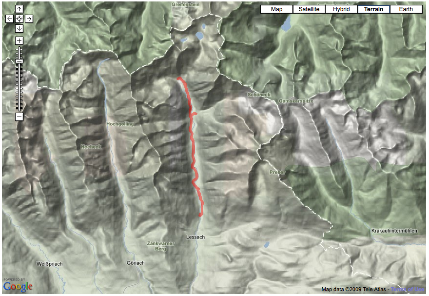
Dec 31: Lessach – Hinteralm
This trip lead through the Lessach valley to the foot of Hochgolling, which at 2863m is the highest point of the Niedere Tauern. There was barely enough snow for skiing on the road leading along the valley – just couple of cm. However, due to the fact that the road surface was not treated with salt or gravel to prevent sliding, I was able to ski most of the way. As the valley is almost without population there were maybe 2 cars that passed by while I climbed up the valley. At the end of the valley lies a group of nice wooden houses of Hinteralmhutten. There I noticed that some of them were build recently, but austrians build even those using materials and style matching the traditional architecture.


Along the way up the valley I noticed wooden boards like the ones shown. On them were described and depicted tragic stories that occurred nearby.

Hinteralmhutten

Hochgolling from Hinteralmhutten

Deichselspitze from Hinteralmhutten

Waterfall near Asendlalm lies less than a km from the valley road

The Lessach valley near Lessach
Jan 1: Prebersee
The first day of the 2010 I drove to Prebersee where a map was indicating presence of cross-country trail leading along the valley that lies about 1500 meters above the sea level (and thus should have enough snow for skiing). This turned out to be the case on both counts – the trails were there, with plenty of groomed snow. The mountain complex to the south stand only about 150 m above the valley and because it forms a more-less plateau, it seemed to be suitable for cross-country skiing. My map reading turned out to be correct which resulted in another great skiing day.
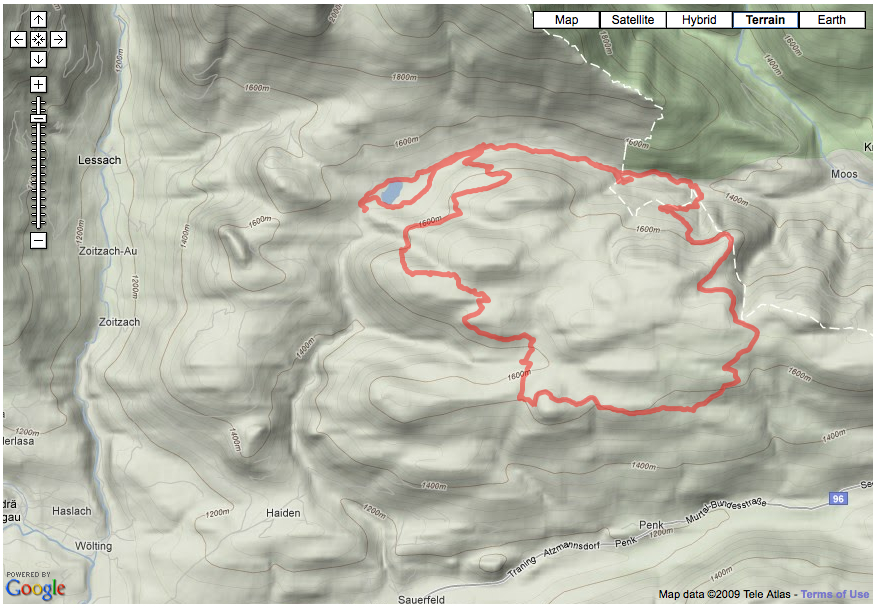

I skied on logging roads most of the time. They were driven on after the snow fall and thus offered good skiing without the need to trail-blaze tracks.

From time to time views opened to the south.


A “modern” wooden hut at Hiaslerhutte and some moss and lichen-covered larch (there is a lot of larch in Lungau) branch nearby

A view at the Fritzenhutte cluster. I haven’t seen anybody living in these mountain huts so I guess they are just holiday dwellings.

a tundra-like landscape of Durenecksee


Wengerhutte – from here I descended back to the Prebersee valley.
How are you doing ?
Next year, Seattle Cherry Blossom Festival is 35th Anniversary. Yes, Tazue and I still doing it.