This entry summarizes trips made during my vacation in National Park Slovensky Raj between Christmas and New Year. While there, I stayed with my family in a private pension in Stratena (Lost) village on the southern edge of the Park.
27 Dec. 2007
X-country ski trip from Besnik pass to Kyprov and back (25 km; 1,050 m climb; 820 m descend).
Having no snow in lower elevations of Slovakia I was concerned there was going to be no place to do x-country skiing before leaving for the trip. I did hope that on high ridges of the mountain ranges around Stratena I would find some opportunities to explore the area on skis. To my delight I saw enough snow to ski in the Besnik Pass (The Fury Pass) while driving to Stratena from home. In the next few days every ski trip I made either started or ended there.
The first trip lead from the pass to Kyprov mountain. Not only was there enough snow to ski on, but there was even either a x-country track or snowmobile path blasted all the way to the point where I turned around on Kyprov. The weather – with no clouds, or wind and tempereatures about -5 degrees centigrade (23 F) – were also superb. There were not many great vista spots, but from time to time I found a clearing in the spruce growths lining the path to get a glimpse of both Tatra ranges to the north (the Nizke and Vysoke Tatry) and cloud-shrouded valleys to the south.

View South from Kyprov

X-country ski tracks were blazed from the starting point all the way to Kyprov.

Kralova Hola in Nizke Tatry. Vysoke Tatry range reaching 2,700 meters (8800 feet) are to the right of Kralova Hola.

Inversion clouds in the Dobsina Valley

The vast expanses of Slovenske Rudohorie awaiting exploration
28 Dec. 2007
X-country ski trip with my father from Besnik pass to Mlynky village (21 km; 820 m climb; 1100 m descend).
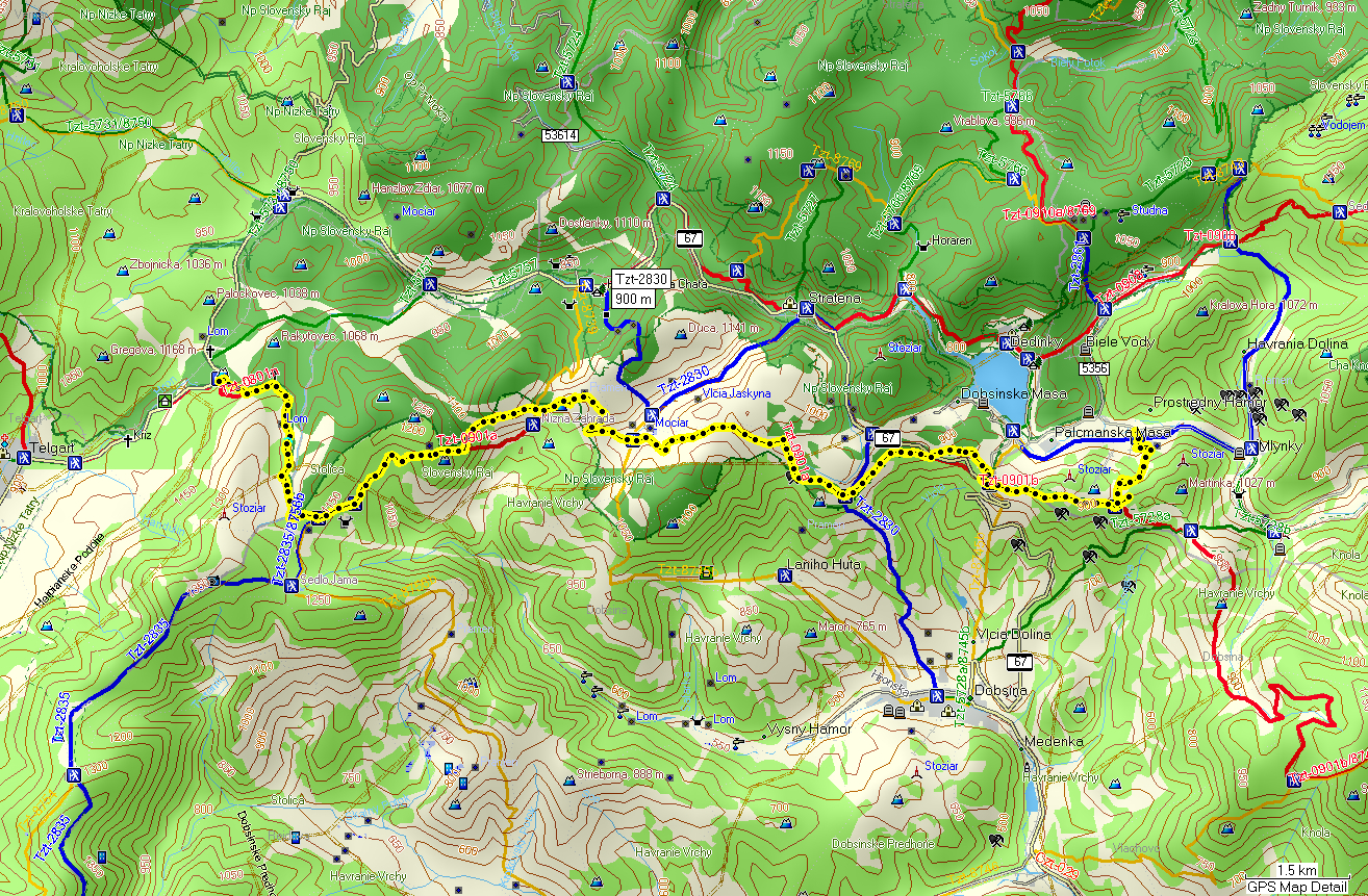
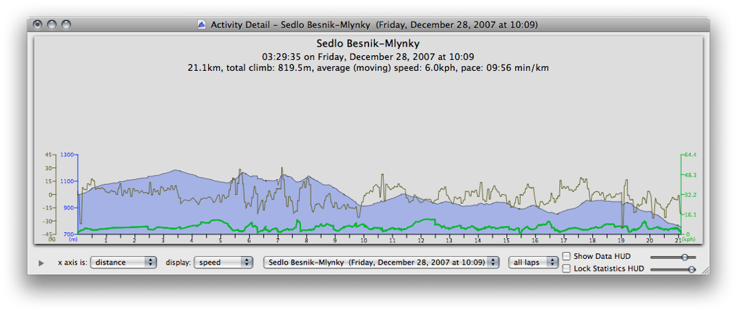
This trip was the most difficult of the three I made during my stay in Slovensky Raj despite of the fact, that it was the shortest with the least climbing segments. The reason was the character of the terrain – more up and down than I experienced on the other 2 trips – combined with lack of snow as we descended from the Besnik Pass (about 1,000 m) to Mlynky village (at about 750 m). Additional factor was the air temperature – as we descended to the elevations below 900 meters we entered the cold inversion clouds that compromised our clothes’ insulation capabilities.

Pod Hannesovou – a carst plateau above the Dobsinska Ladova Cave and Stratenska Cave. The second one has the largest dome of all Slovak caves with volume of 79,017 m3. It is also one of the longest at 22 km.

In the passes where the wind blew-in the moisture-ladden inversion air the ground was covered by large, beautiful ice crystals.
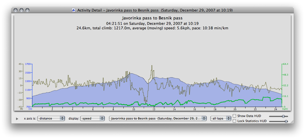
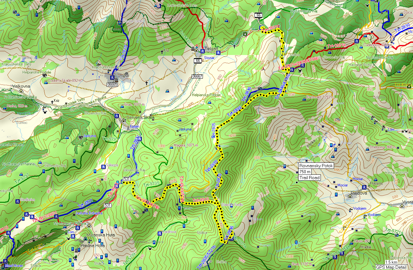
29 Dec. 2007
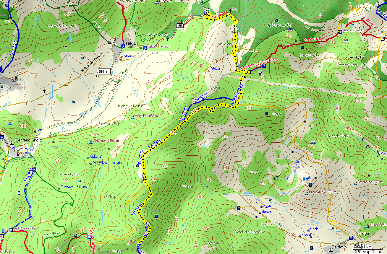
X-country ski trip with my father from Javorinky Pass to the Besnik Pass (21 km; 1,200 m climb; 960 m descend).
Just like the previous day also this one was a one-way trip. My father and I both drove cars – we left one in the Besnik and drove to Javorinky where we started the trip. The first half of the trip was a very gradual climb to the Stolica mountain summit. Long time ago my friends used to work and live down in the valley in Karafova and during my visits I always wanted to climb the mountain – this was a good opportunity. In Slanske sedlo below starting the ascend we met 3 hikers who also headed up. After a short rest we started our ascent only to meet them again at the top. On the way down from the summit we met another skier going the same direction as we did – he was Czech. Later on Kyprov we met a group of maybe 12 more Czech skiers going the opposite direction. This was not the first time I encountered disproportionately more Czech turists than Slovaks in our mountains. The mountain-going tradition in that country seems to be much stronger that in ours. I think this has to do with the fact that Czech lands have more big cities and traditionally been more industrialized than Slovakia so there was a greater percentage of population that needed to “get out” to relax in the nature. Slovakia on the other hand – until recently – with its agriculture-based economy did not provide enough incentives for its inhabitants to seek recreation in the mountains.


The scenery west of Kyprov – the Muranska Zdychava valley shrouded in clouds

Father climbing the highest point of our trip – Stolica (1,476 m – as measured by GPS device)


The Stolica summit is flat and covered with trees thus not offering many views, but we found this spot facing north to take the “summit” photos.
30 Dec. 2007
Hike from Stratena to Havrania Skala (8.6 km; 594 m climb/descend).
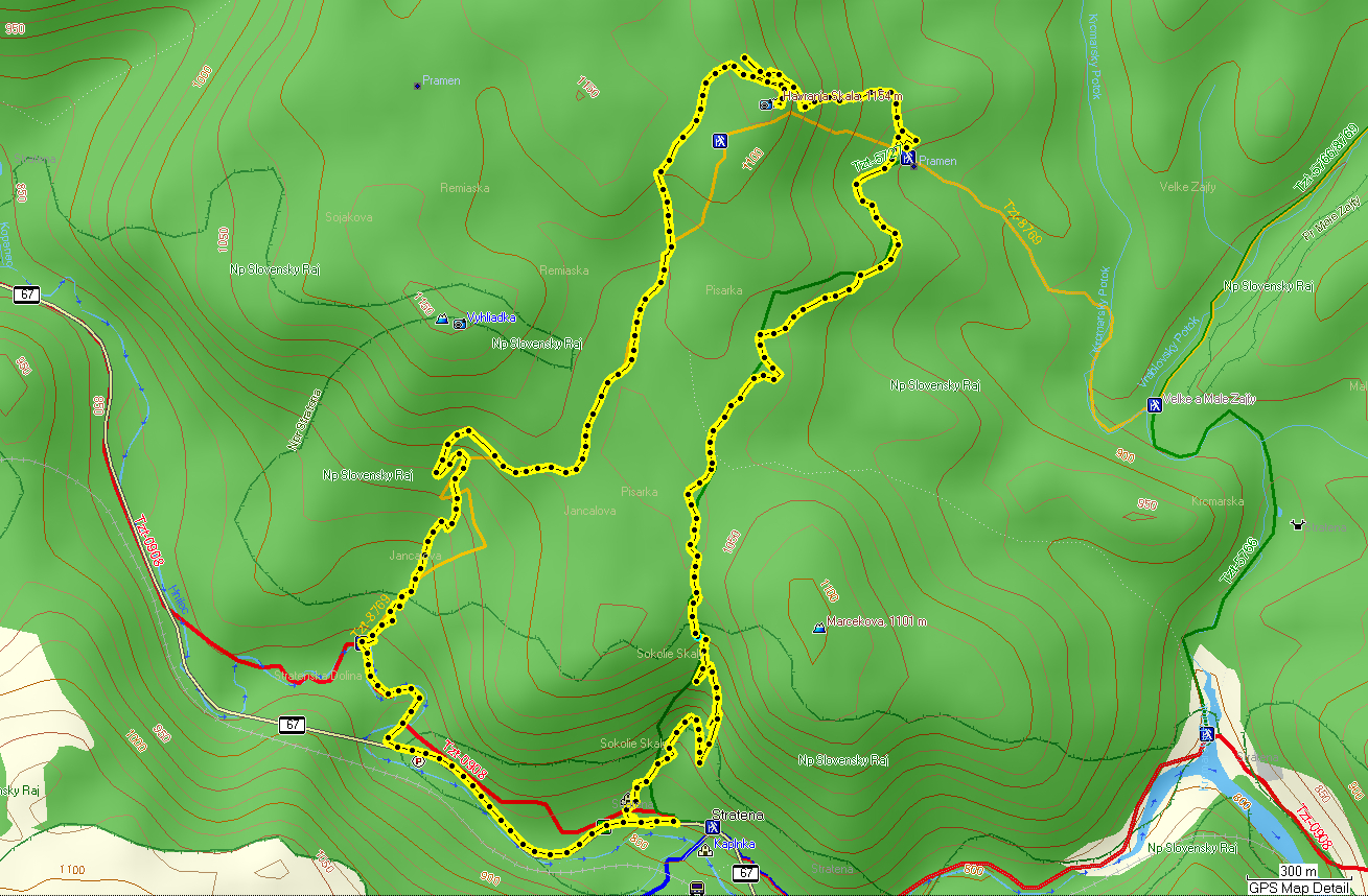
This was the last day of our stay in Stratena and having skied the past 3 days, I decided to do a hike up to Havrania Skala which is located just a couple of km from Stratena. It is a rocky edge of a limestone plateau with great views towards the south and east. As a winter hike one gets a bonus of having a pretty decent view of the High Tatras to the north as there are no leaves on the trees.

Climbing up the small canyon of Sokolie Skaly just above Stratena I saw this small cave with ice stalagmites.


Views east and south from Havrania Skala.

The High Tatras range view to the north

Slovensky Raj scenery